Maryland Appalachian Trail #7, 4-26-2025
Note: The following numbers represent what I did on this hike and should be taken with a grain of salt. There were two optional walks, a large loop crossing Virginius Island and the AT, and a shorter walk just up to Jefferson Rock and back. In addition there was a large amount of free time in Harpers Ferry and people would have done different amounts of walking around during that time. At best, these numbers just show a sort of average.
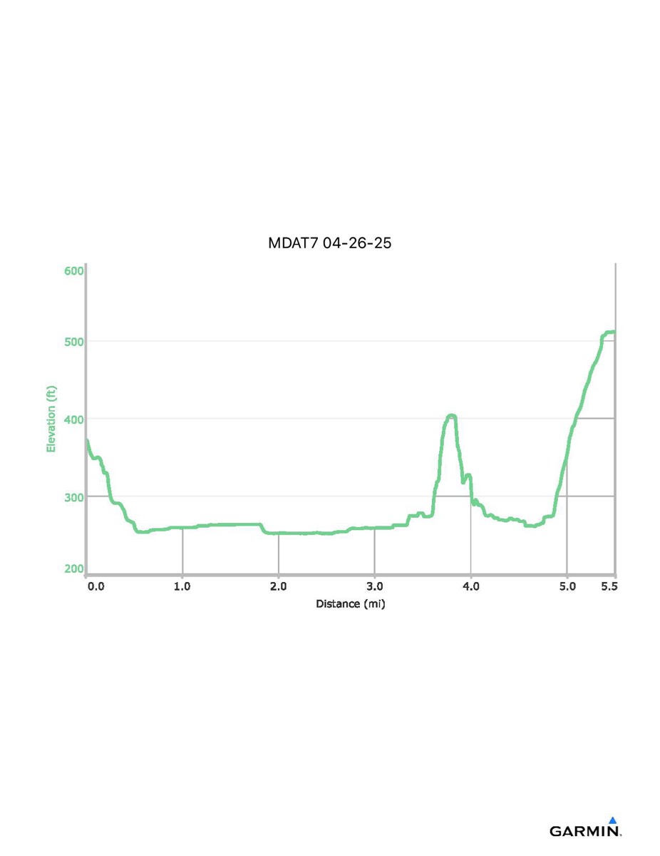
Distance - 5.5 mi
Time - 5:08
Total Ascent - 441 ft
Total Descent - 303 ft
Max Elevation - 512 ft
Min Elevation - 253 ft
Distance - 5.5 mi
Time - 5:08
Total Ascent - 441 ft
Total Descent - 303 ft
Max Elevation - 512 ft
Min Elevation - 253 ft