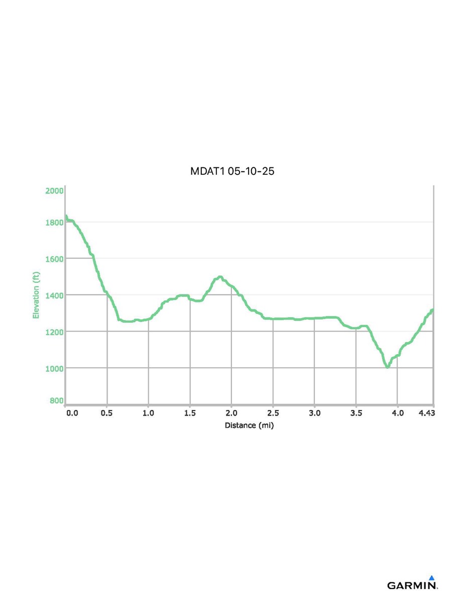
Maryland Appalachian Trail #1, 5-10-2025 (partial)
Distance - 4.4 (5.8) mi
Time - 3:34 (4:14)
Total Ascent - 627 (945) ft
Total Descent - 1143 (1612) ft
Max Elevation - 1835 ft
Min Elevation - 1001 ft
NOTE: I left this hike at Buena Vista Road so the map, profile, and data files only reflect the first part of the hike. The numbers above in parentheses are approximate values for those who finished the entire hike. The blue line on the map shows the final part of the hike (which I did not do). To see a profile of the entire hike, choose one of the dates that does not say "partial".